Free walk leaflets
Our Ranger Service and the Public Rights of Way Team have created leaflets for a number of popular walks that you are free to download and print off.
We recommend printing these leaflets in colour to ensure that the included maps are as clear as possible. Due to the age of a number of these leaflets, it has not been possible yet, to make them fully accessible. Should you require assistance to access the information contained the PDF documents, email the web team who will endeavour to provide assistance.
Walking advice
Remember to follow the Countryside Code when out in the countryside. Wear comfy, strong shoes or walking boots, take a waterproof coat and a drink to keep hydrated and a snack too on a longer walk. You may find steps, uneven ground, slopes, loose surfaces, vegetation and livestock on some paths. In addition to any walks leaflet it’s a good idea to carry a map with you: the Ordnance Survey’s Explorer maps are ideal.
Stile-free walks
If you’re looking for a walk that has no stiles on it, then take a look at one of the following list of routes and leaflets. You’ll also find accessible routes at our countryside sites and on the Peak District National Park’s Miles without Stiles webpage.
Walks for all in Cheshire East
Steps and stiles can be a problem for many of us, so why not take a walk where you won’t encounter any? Ten routes of varying lengths are suggested here to give you a flavour of the Cheshire East countryside. Explore, take healthy exercise and enjoy a sense of wellbeing from being outdoors!
This leaflet contains a selection of walks for all abilities, including those with pushchairs, wheelchairs and mobility scooters. This leaflet has been revised and updated for spring 2017 and features routes that have been improved for easier access since the last publication of the leaflet.
The walks for all leaflet (PDF, 5.5MB) can be viewed with screen reader technology, but if you need help or require it in a different format please contact the web team.
More walks for all in Cheshire East
Following on from the popular Walks for All leaflet, this publication brings you ten more routes in the Cheshire East countryside. The routes are free from steps and stiles so are suitable for all abilities, including those with pushchairs, wheelchairs and mobility scooters.
More Walks for All was brought to you in partnership with the Cheshire East Local Access Forum.
The Forum provides advice on how to make the countryside more accessible and enjoyable for open air recreation.
The more walks for all leaflet (PDF, 13MB) document can be viewed with screen reader technology, but if you need help or require it in a different format please contact the web team.
Footpaths to fitness in Congleton
Join the Walker family and discover healthy countryside walks right on your doorstep.
This leaflet contains a map of the Bromley Farm area of Congleton with a number of self-guided walk suggestions.
There are lots of footpaths and bridleways to enjoy nearby, as well as the Biddulph Valley Way and Macclesfield Canal towpath.
Footpaths to fitness self guided walk leaflet (PDF, 1.1MB)
Footpaths to fitness in Tatton Park
Tatton Park has 1,000 acres of Parkland to explore. Get active and enjoy some of Tatton’s tremendous views on this circular walk along Tatton mere and around the park. Use the easy-to-follow directions in this leaflet and follow the Footpaths to Fitness waymarks along the route. Entry is free for pedestrians.
Footpaths to fitness Tatton Park leaflet (PDF, 1MB)
This document can be viewed with screen reader technology, but if you need help or require it in a different format please email the web team.
Walks and Wildlife South of Congleton
Explore the area south of Congleton with this newly revised leaflet contains 5 walks ranging from 1 to 4 miles using country lanes, footpaths and bridleways.
Maps and directions will help you find your way, whilst details about the wildlife and landscape that you will discover are also provided.
Copies of the leaflet are available from Astbury Mere Country Park, Congleton tourist information centre, Congleton library and by phoning 01270 686059.
Walks and wildlife south of Congleton (PDF, 3.9MB)
Rail walks in Knutsford and surrounding villages
Choose one of the walks in the Rail Walks leaflet and leave the car behind. Prepared by Knutsford Local Area Partnership and the Mid-Cheshire Rail Users’ Association, the leaflet offers 5 circular routes from local railway stations: Plumley, Ashley, Knutsford, Mobberley and Chelford – and all routes include a pub for a refreshment stop!
This leaflet is a new edition containing updated maps, directions and information. The Ashley Rail Trail and the Chelford Village Walk routes within this leaflet are now free from stiles, making the paths easier for all.
The Knutsford rail walks (PDF, 1.1MB) PDF is not accessible to screen reader technology, if you require it in a different format please contact the web team.
Nantwich Riverside Loop
Walkers can stretch their legs on the pleasant Nantwich Riverside Loop walk and enjoy getting to know the countryside within such easy reach of Nantwich town centre. The Loop follows a 5km (3 mile) circular route alongside the River Weaver, across the fields to the canal, up to the aqueduct and then back to town via the historic Welsh Row.
Nantwich Riverside Loop leaflet (PDF, 5MB)
The Gritstone Trail
Temporary path closure on the Gritstone Trail
A section of the Gritstone Trail is temporarily closed due to an unsafe bridge. See the Gritstone Trail page for details of an alternative route.
Stride out along the Gritstone Trail and sample some of the finest walking in Cheshire. There are stunning views in all directions from the gritstone ridges abutting the Cheshire plain. On a clear day you’ll see views to the Welsh hills and the cathedrals of Liverpool. Along the route there’s a variety of interesting landmarks and features.
The Gritstone Trail Walkers' Guide (PDF, 1.9KB)
Ranger service circular walks
These circular walks are of various lengths and difficulties and range from a gentle stroll along the Middlewood Way through to a six-mile hill walk up into Lyme Park and beyond.
The walks depart from 2 locations within Cheshire East:
We recommend that these leaflets are printed in colour to ensure that the included maps are as clear as possible.
8 Circular walks from Nelson Pit visitors centre
All the walks below depart from and return to the Rangers Visitors Centre - Nelson Pit in Higher Poynton. Directions to the visitors centre are as follows: From the main lights in Poynton, go up Park Lane, after 1km fork left down Middlewood Road (signposted Davenport Golf Club). Take first right (brown sign for Nelson Pit). Centre is opposite the Boar’s Head pub. (Map ref: SJ 945833). If you are using satellite navigation, the nearest postcode is SK12 1TH. See a Google Map of Nelson Pit.
Please note: Access to Lyme Park, via side gates mentioned in the below walks, may be restricted currently as the National Trust are operating bookable access only. To find out more visit the Lyme Park National Trust website or contact them direct.
Walk 1 from Nelson Pit Visitors Centre
 Distance: About 3 miles
Time: About 1 hour 30 minutes
Terrain: Easy
Route: Macclesfield Canal, Middlewood Station,
Jacksons’ Brickworks and Middlewood Way
Nelson Pit Walk Leaflet 1 (PDF, 310KB)
Walk 2 from Nelson Pit Visitors Centre

Distance: About 4.5 miles (please note that the distance is overstated in the leaflet)
Time: About 2 hour 30 minutes
Terrain: Some uphill sections
Route: Lyme Park, The Cage, Middlecale Wood
and Middlewood Way
Nelson Pit Walk Leaflet 2 (PDF, 281KB)
Walk 3 from Nelson Pit Visitors Centre
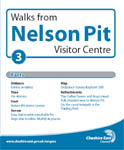
Distance: About 4 miles
Time: About 1 hour 40 minutes
Terrain: Easy
Route: Macclesfield Canal, Hagg Farm,
Poynton Coppice and Anson Road
Nelson Pit Walk Leaflet 3 (PDF, 343KB)
Walk 4 from Nelson Pit Visitors Centre
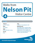
Distance: About 2 miles
Time: About 1 hour 10 minutes
Terrain: Easy
Route: Macclesfield Canal, Lyme View Marina,
and Middlewood Way
Nelson Pit Walk Leaflet 4 (PDF, 666KB)
Walk 5 from Nelson Pit Visitors Centre

Distance: About 3 miles
Time: About 1 hour 30 minutes
Terrain: Moderate
Route: Middlewood Way, Poynton Coppice,
Poynton Brook and Macclesfield Canal
Nelson Pit Walk Leaflet 5 (PDF, 1.5KB)
Walk 6 from Nelson Pit Visitors Centre

Distance: About 3-4 miles
Time: About 2 hours
Terrain: Moderate
Route: Macclesfield Canal, Platt Wood Farm,
Lyme Park and Haresteads Farm
Nelson Pit Walk Leaflet 6 (PDF, 1.3KB)
Walk 7 from Nelson Pit Visitors Centre

Distance: About 6 miles
Time: About 3 hours
Terrain: Strenuous in parts
Route: Macclesfield Canal, Lyme Park, Gritstone
Trail, Bowstones, Lyme Hall
and Mount Vernon Wharf
Nelson Pit Walk Leaflet 7 (PDF, 489KB)
Walk 8 from Nelson Pit Visitors Centre

Distance: About 2.5 miles
Time: About 1 hour 15 minutes
Terrain: Easy
Route: Middlewood Way, Middlewood Station,
and Macclesfield Canal
Nelson Pit Walk Leaflet 8 (PDF, 646KB)
4 Circular walks from Adlington Road car park, Bollington
All the walks below depart from and return to the Rangers Office - Adlington Road Car Park in Bollington. Directions to the car park are as follows: From A523 follow signs into Bollington. After 2km, the road goes under the old railway viaduct. 75m past here, turn left at the Dog and Partridge pub. Car park is 100m on left (Map ref: SJ 930781). See a Google Map of Adlington Road.
Walk 1 from Adlington Road Car Park, Bollington
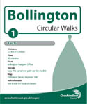
Distance: About 1.5 miles
Time: About 40 minutes
Terrain: Easy - The canal towpath can be muddy
Route: Rangers Office, Macclesfield Canal,
Holehouse Lane, Middlewood Way
Bollington Walk Leaflet 1 (PDF, 280KB)
Walk 2 from Adlington Road car park, Bollington
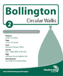
Distance: About 3.5 miles
Time: About 1 hour 30 minutes
Terrain: Easy - Steep climb at the start
Route: Rangers Office, Middlewood Way, Macclesfield
Canal, Tinkers Clough, Adelphi Mill
Bollington Walk Leaflet 2 (PDF, 218KB)
Walk 3 from Adlington Road car park, Bollington
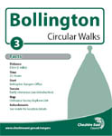
Distance: About 5 miles
Time: About 2 hours 30 minutes
Terrain: Moderate - Some hillwalking
Route: Rangers Office, Macclesfield Canal, Kerridge,
White Nancy, Kerridge Hill, ‘Rally Road’, Middlewood Way
Bollington Walk Leaflet 3 (PDF, 445KB)
Walk 4 from Adlington Road Car Park, Bollington
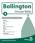
Distance: About 5 miles
Time: About 2 hours 30 minutes
Terrain: Moderate
Route: Rangers Office, Middlewood Way, Bartons
Clough, Sugar Lane, Long Lane, Macclesfield
Canal
Bollington Walk Leaflet 4 (PDF, 491KB)
More walks and walking information
Walking links
Page last reviewed: 16 September 2025
Thank you for your feedback.